24 Hours Hotline: +86 137-3541-1378
Email:beijing@tripstoshanghai.com
24 Hours Hotline: +86 137-3541-1378
Email:beijing@tripstoshanghai.com

Overview of Victoria Harbor
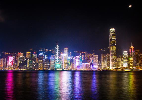
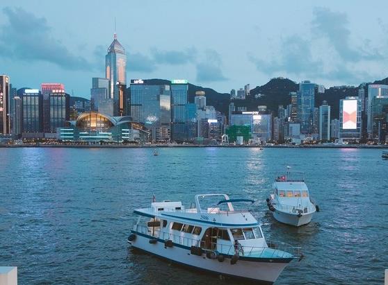
Victoria
Harbour is a natural landform harbour situated between Hong Kong Island
and Kowloon in Hong Kong. The harbour's deep, sheltered waters and
strategic location on the South China Sea were instrumental in Hong
Kong's establishment as a British colony and its subsequent development
as a trading centre.
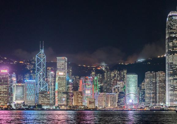
Long famous for
its spectacular views, the harbour is a major tourist attraction of Hong
Kong. Lying in the middle of the territory's dense urban region, the
harbour is the site of annual fireworks displays and its promenades are
popular gathering places for tourists and residents.
History
The
first reference to what is now called Victoria Harbour is found in
Zheng He's sailing maps of the China coast, dated c.1425, which appear
in the Wubei Zhi (A Treatise on Armament Technology), a comprehensive
17th-century military book. While the harbour was charted in later maps,
the first map depicting it in detail is an 1810 marine chart prepared
for the East India Company by Daniel Ross and Philip Maughan,
lieutenants of the Bombay Marine.
During the Taiping Rebellion, armed rebels paraded the streets of Hong Kong. On 21 December 1854, the Hong Kong police arrested several armed rebels who were about to attack Kowloon City. On 23 January 1855, a fleet of Taiping war boats was on the verge of a naval battle against Chinese imperial war boats defending the harbour. The Chinese defenders were ordered away by the British colonial authorities. These incidents caused rising tension that would eventually lead to the Arrow War. The harbour was originally called "Hong Kong Harbour", but was later renamed as "Victoria Harbour", to assure shelter for the British fleet under Queen Victoria.

The
subject of pollution came to the fore in the 1970s with the rapid
growth of the manufacturing sector. The water club races were stopped in
1973 due to pollution in the harbour, a year after the RMS Queen
Elizabeth burned and capsized there. Studies also showed excessive
nitrogen input from discharges of the Pearl River Delta into the harbour
for decades.
After completion of
the Central and Wan Chai Reclamation Feasibility Study in 1989, the
Land Development Policy Committee endorsed a concept for gradual
implementation of this additional reclamation. It consists of three
district development cells separated by parks, namely, Central, Tamar
and Exhibition.
The latest
proposed reclamation, extending along the waterfront from Sheung Wan to
Causeway Bay, faced public opposition, as the harbour has become a
pivotal location to Hongkongers in general. Activists have denounced the
government's actions as destructive not only to the natural
environment, but also to what is widely considered as one of the most
prized natural assets of the territory. NGOs, including the Society for
Protection of the Harbour, were formed to resist further attempts to
reduce the size of the waterbody, with its chairman, Christine Loh,
quoted as saying that the harbour "...is a precious national asset and
we must preserve it for future generations. I believe an insightful and
visionary chief executive would support our stance and work with us to
protect the harbour". Reclamation work also led to the demolition of
Queen's Pier and Edinburgh Place Ferry Pier, structures of historic
significance, to massive public opposition.
Geography
Victoria
Harbour covers an area of about 41.88 km2 (16.17 sq mi) as of 2004. The
eastern boundary is generally considered to be the line formed between
the westernmost extremity of Siu Chau Wan (???) and A Kung Ngam. The
western boundary is generally considered to consist of a line drawn from
the westernmost point of Hong Kong Island to the westernmost point of
Green Island, thence a straight line drawn from the westernmost point of
Green Island to the southeastern-most point of Tsing Yi, thence along
the eastern and northern coastal lines of Tsing Yi to its westernmost
extremity, and thence a straight line drawn true north towards the
mainland.

Prev: The Bund (Waitan)
Next: Potala Palace
Wechat: Chinaprivatetour
24 Hours Hotline:
+86 137-3541-1378
* Authentic Experiences: Genuine local experiences that immerse you in the true essence of Beijing and beyond.
* Safety First: Highest safety standards with secure activities and reliable transportation.
* Customizable Tours: Flexible itineraries tailored to your interests and needs.
* Local Expertise: In-depth knowledge of Beijing and China, offering exclusive insights.
* Professional Guides: Licensed bilingual guides with over 5 years of experience.
* Comfortable Travel: Experienced drivers and well-maintained vehicles for a smooth journey.
* Sustainable Tourism: Commitment to responsible tourism and supporting local communities.
* Customer-Focused: Personalized service and continuous improvement based on your feedback.
* Free Cancellation: Cancel up to 24 hours before travel for flexibility and peace of mind.
* 24/7 Support: Round-the-clock assistance for any questions or help needed.
1 to 1 tailor-made service from our professional travel advisors for the most sophisticated
Constantly excellent reviews for attraction, hotel and service Competitive price
Local experts provide quality tours Best selected knowledgeable local guides Authentic local restaurants
7*24 hours available to create you a worry-free tour. No Hidden Fees and absolutely no pressure to buy. Secured


Copyright © 2017 Chinabeijingprivatetour.com All rights reserved. 浙ICP备18056007号-2